
National Historic Trails span over 36,000 miles across 41 states, connecting you to key moments in U.S. history. These congressionally designated routes highlight migration, exploration, trade, and cultural shifts that shaped the nation. From the 5,600-mile California Trail to the 54-mile Selma to Montgomery route, these trails offer a mix of hiking, driving, and museum visits, making history accessible to everyone.
Key Points:
- What They Are: Long-distance routes preserving paths tied to historic events like westward expansion and the Civil Rights Movement.
- How They’re Designated: Congress evaluates trails for national historical importance, public interest, and recreational potential.
- Trail Highlights: Examples include the Oregon Trail (migration), the Trail of Tears (displacement), and the Santa Fe Trail (trade).
- How to Explore: Options include hiking, driving, and visiting historic landmarks with resources like NPS maps and guides.
These trails aren’t just paths – they’re windows into the past. Whether you’re walking wagon ruts or crossing the Edmund Pettus Bridge, each journey connects you to America’s story.
History and Overview of National Historic Trails
How National Historic Trails Began
The roots of National Historic Trails trace back to the 1960s, a time when outdoor recreation was becoming increasingly popular. A survey conducted in 1960 found that 90% of Americans engaged in some form of outdoor activities, prompting Congress to respond to the growing demand for protected trail systems. This movement led to the creation of the National Trails System Act of 1968 (Public Law 90-543), which laid the groundwork for a nationwide network of trails.
Initially, the 1968 Act focused on scenic and recreational trails, but it paved the way for the recognition of routes with historical and recreational importance. A decade later, the National Parks and Recreation Act of 1978 expanded the original legislation, introducing the National Historic Trail category. This amendment officially designated the first four historic trails: the Oregon, Mormon Pioneer, Iditarod, and Lewis and Clark National Historic Trails. President Lyndon B. Johnson captured the vision for these trails with a powerful statement:
"Your imagination, your initiative, and your indignation will determine whether we build a society where progress is the servant of our needs, or a society where old values and new visions are buried under unbridled growth".
Since the initial legislation, 45 long-distance trails have been studied for potential inclusion. Today, the system includes 21 designated National Historic Trails, covering an impressive 36,000 miles.
The Designation Process
The designation of National Historic Trails ensures their historical significance is preserved while encouraging exploration in modern times. Only Congress has the authority to designate these trails, and it does so through an Act of Congress. Before a trail can be officially recognized, it must undergo a thorough study to confirm it meets the criteria outlined in Section 5(b) of the Act. To qualify, the trail must satisfy three specific requirements:
- Historical Use and Significance: The route must have been established through historic use and hold historical importance because of that use.
- National Significance: Its importance must extend beyond local or regional history to have a broader impact on American history.
- Recreational or Historical Interest: The trail must offer clear potential for public recreational use or historical appreciation through interpretation.
These standards ensure that only routes with a meaningful national legacy are designated. The system continues to grow, with recent additions like the Chilkoot National Historic Trail in 2022 and the Butterfield Overland National Historic Trail in 2023, reflecting the ongoing recognition of historically significant routes.
Trail Management and Oversight
Once a trail is designated, careful management ensures its historical authenticity and accessibility are preserved. Each trail is assigned to a lead federal agency for administration. Currently, the National Park Service (NPS) oversees 21 long-distance trails, the U.S. Forest Service manages 6, and the Bureau of Land Management (BLM) is responsible for 1. Additionally, two trails – El Camino Real de Tierra Adentro and the Old Spanish National Historic Trail – are jointly administered by the NPS and BLM.
The National Trails System differentiates between "administration" and "management." Administration involves overarching responsibilities like planning, marking, funding, and protecting resources along the entire trail. Management, on the other hand, refers to the day-to-day operations of specific segments, often handled by the landowners of those sections. For example, a Forest Service-administered trail segment passing through a National Park might be managed locally by the NPS under an interagency agreement.
State and local governments also play a key role in maintaining these trails through cooperative agreements that cover law enforcement, land protection, and signage for motor tour routes. The BLM alone manages nearly 6,000 miles of 19 designated trails across 15 states. Non-profit groups, volunteers, and private landowners are equally vital, forming what the NPS describes as a "nationwide trails community." This collective effort ensures that trails crossing non-federal lands are protected and maintained, blending historical preservation with opportunities for modern exploration.
sbb-itb-00512f3
Lewis and Clark National Historic Trail: Partnerships for the Future 16 min
The 19 National Historic Trails

National Historic Trails Length and Coverage Comparison Chart
Complete List of National Historic Trails
The United States boasts 19 officially designated National Historic Trails, spanning over 31,000 miles and crossing through 41 states. These trails serve as a living connection to some of the most defining moments in American history, from exploration and migration to trade, military campaigns, and social movements.
Among these, the California National Historic Trail stands out as the longest, stretching an impressive 5,600 miles across 10 western states. On the other end of the spectrum, the Selma to Montgomery National Historic Trail covers just 54 miles in Alabama, yet it holds immense historical importance as a symbol of the Civil Rights Movement. Between the 1830s and 1860s, three major trails – the Oregon, California, and Mormon Pioneer Trails – helped approximately 500,000 emigrants journey westward, reshaping the American landscape in the process.
Each trail tells a unique story. The Trail of Tears remembers the forced relocation of Native Americans, while the Lewis and Clark National Historic Trail celebrates exploration. Others, like the Selma to Montgomery Trail, commemorate pivotal social struggles. Below, we’ll explore some of the key highlights and landmarks along these iconic routes.
Featured Trails and What to See
The Oregon Trail, once the path for hundreds of thousands of settlers, still reveals traces of its past. Visitors can see original wagon ruts or stop at landmarks like Fort Kearny State Historical Park in Nebraska. This area was a crossroads for four major trails – the Oregon, California, Mormon Pioneer, and Pony Express Trails – making it a vital hub for westward expansion. These routes often followed the Platte River, offering settlers crucial access to water and smoother terrain for their wagons.
The Pony Express National Historic Trail highlights the daring efforts of 19th-century mail carriers. Spanning 2,000 miles across eight states, it became legendary for its horseback riders who delivered mail between Missouri and California. Today, modern relay events honor their legacy.
For those drawn to the history of the Civil Rights Movement, the Selma to Montgomery National Historic Trail offers a powerful experience. Walking across the Edmund Pettus Bridge, visitors can retrace the steps of the 1965 voting rights march. Similarly, the Washington-Rochambeau Revolutionary Route takes history enthusiasts along the 700-mile path traveled by American and French troops during the Revolutionary War.
Another standout is the Santa Fe Trail, a critical trade route that connected Missouri to New Mexico over 1,203 miles. This trail transformed commerce in the Southwest, and today, sections of it run alongside modern highways, providing a striking contrast between past and present.
These trails represent just a glimpse of the experiences available across the network, offering visitors a chance to engage with America’s history in meaningful ways.
Trail Lengths and Coverage Comparison
| Trail Name | Length (Miles) | States Covered | Primary Theme |
|---|---|---|---|
| California | 5,600 | 10 (CA, CO, ID, KS, MO, NE, NV, OR, UT, WY) | Migration (Gold Rush) |
| Trail of Tears | 5,045 | 9 (AL, AR, GA, IL, KY, MO, NC, OK, TN) | Forced Displacement |
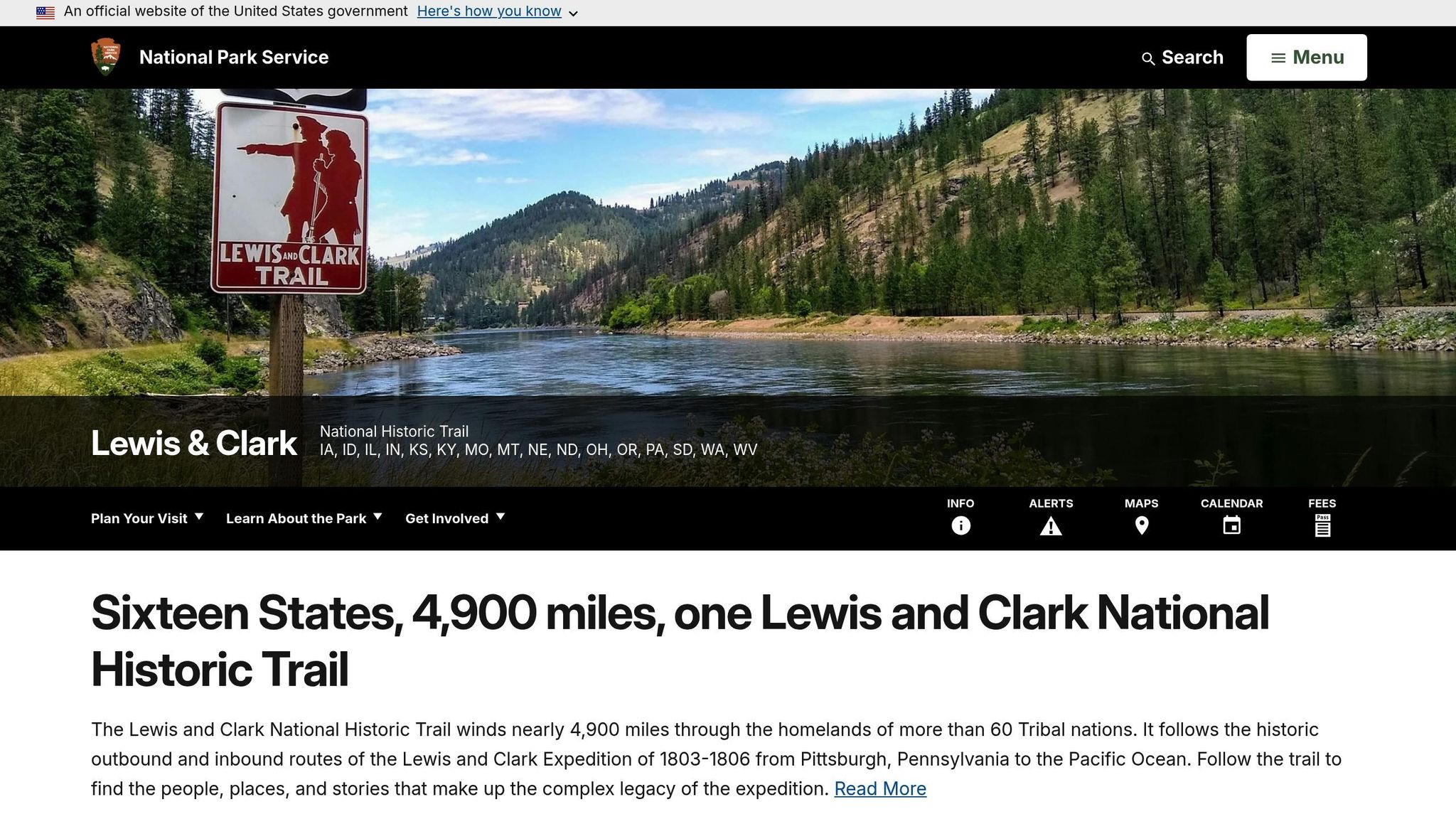
| Lewis and Clark | 4,900 | 16 (PA to WA) | Exploration |
| El Camino Real de Tierra Adentro | 404 | 2 (NM, TX) | Spanish Colonial Trade |
| Captain John Smith Chesapeake | 3,000 | 6 (VA, MD, DE, DC, PA, NY) | Exploration (Water Route) |
| El Camino Real de los Tejas | 2,600 | 2 (TX, LA) | Spanish Colonial Trade |
| Old Spanish | 2,700 | 6 (AZ, CA, CO, NV, NM, UT) | Trade |
| Iditarod | 2,400 | 1 (AK) | Communication |
| Oregon | 2,170 | 7 (ID, KS, MO, NE, OR, WA, WY) | Migration (Settlement) |
| Pony Express | 2,000 | 8 (CA, CO, KS, MO, NE, NV, UT, WY) | Communication (Mail) |
| Mormon Pioneer | 1,300 | 5 (IL, IA, NE, UT, WY) | Migration (Religious) |
| Santa Fe | 1,203 | 5 (CO, KS, MO, NM, OK) | Trade |
| Juan Bautista de Anza | 1,200 | 2 (AZ, CA) | Exploration |
| Nez Perce (Nee-Me-Poo) | 1,170 | 4 (ID, OR, MT, WY) | Conflict |
| Washington-Rochambeau | 700 | 10 (MA to VA) | Military (Revolutionary War) |
| Star-Spangled Banner | 560 | 3 (DC, MD, VA) | Military (War of 1812) |
| Overmountain Victory | 330 | 4 (NC, SC, TN, VA) | Military (Revolutionary War) |
| Ala Kahakai | 175 | 1 (HI) | Native Hawaiian Culture |
| Selma to Montgomery | 54 | 1 (AL) | Civil Rights |
How to Explore National Historic Trails
Planning Your Trip
Visiting National Historic Trails is like stepping into a living history book, but planning is essential to make the most of your journey. These trails include a mix of traditional paths, roads, and privately owned sections, so preparation ensures a smoother experience.
Start by deciding how you want to explore: by car, on foot, by bike, or perhaps through visits to historic landmarks and museums. To help navigate, download ATR interpretive guides and check out the National Park Service’s interactive GIS maps, which highlight historic sites and trail segments.
Don’t forget to check the National Park Service Alerts page for any closures, weather updates, or safety notices. If your route crosses private property, research land ownership ahead of time. Some sections of historic trails might be visible but not accessible for walking. As the National Park Service explains:
"Planning a trail-long adventure takes creativity, but rewards the traveler with rich American experiences."
Activities and Accessibility Options
National Historic Trails offer a wide range of ways to connect with history. You can explore by car along marked motor tour routes that often run parallel to the original paths, or you can hike, bike, ride horseback, ski cross-country, kayak, or visit historic forts and museums. These options make the trails accessible to a variety of interests and abilities.
If you’re hiking, look for the “ruts and swales” left behind by wagons from centuries past – they’re a powerful reminder of those who traveled before us. For those who need easier access, many trails run along paved roads or pass through urban areas, making them more accessible. Check the individual trail websites for specific details and accessibility tips.
Whatever activity you choose, take time to prepare for the conditions and terrain you’ll encounter.
Safety and What to Bring
The landscapes along National Historic Trails are as diverse as the stories they tell, covering everything from remote wilderness to urban stretches. Depending on the region and season, you could face intense heat, freezing cold, high winds, or even blizzards. Some trail segments also include water routes, so paddlers will need the right safety gear.
Pack equipment suited to your chosen activity – whether that’s sturdy hiking boots, cycling gear, or paddling essentials. If you’re heading into more isolated areas, bring extra supplies to account for the lack of nearby services. Always respect private property boundaries, as some historic routes, while visible, aren’t open to the public. Use ATR guides and specialized maps to navigate these areas safely and responsibly.
Resources for Trail Exploration
Once your trip is planned and your activities are set, it’s time to gather reliable tools to help you navigate these historic trails with confidence.
The National Park Guide

For a well-rounded starting point, check out The National Park Guide (https://thenationalparkguide.com). This resource offers a treasure trove of information on National Historic Trails, combining historical insights with practical travel tips. Whether you’re curious about the history behind these routes or need advice on visiting specific sites, this guide helps you prepare for your journey. It’s a great way to get an overview before diving into more detailed planning tools.
Official Trail Websites and Maps
The National Park Service National Trails System website (nps.gov/subjects/nationaltrailssystem) is your go-to source for official updates on all 19 National Historic Trails. Each trail page includes alerts, safety notices, and detailed maps. Be sure to check the "Alerts" section for any closures or weather-related updates before heading out.
For a deeper dive into trail mapping, visit the Partnership for the National Trails System (PNTS) Map Portal at pnts.org. This tool allows you to explore trail routes in both 2D and 3D formats, with options to overlay maps on satellite imagery or street views at a 1:100,000 scale. If you’re planning a road trip, the Auto Tour Route Interpretive Guides are invaluable. These guides, available for trails like the Oregon, California, and Pony Express, provide state-by-state driving directions along with information on historic markers and key points of interest.
Before venturing into remote areas, download the 2024 PDF map from the NPS for offline use. For hyper-local details, consider reaching out to the managing agency for that specific trail segment – whether it’s the NPS, BLM, or USFS.
Conclusion
National Historic Trails offer a chance to step into history. Stretching across the country, these trails highlight key moments that shaped America – from the bravery of early explorers to the determination of westward migrants. Along these paths, you can find original wagon ruts and landmarks that once guided around 500,000 emigrants heading west, creating a tangible connection to the past.
What makes these trails special is how easy they are to explore. Whether you’re looking for a quick weekend trip or a scenic drive, they’re accessible with little preparation. Trails like the 5,665-mile California National Historic Trail or the 54-mile Selma to Montgomery route provide options for all interests and schedules.
With tools like official NPS maps, interactive guides, and The National Park Guide, planning your journey is simple. While exploring, look for remnants of history, visit museums that share diverse stories, and take a moment to feel the same wind and silence that travelers of the past experienced.
These trails are more than just paths – they’re connections to the people and events that built the nation. Dive into the journey today and discover the stories waiting to be uncovered. Your adventure into history starts now.
FAQs
What’s the best way to plan a trip to explore multiple National Historic Trails?
If you’re dreaming of exploring multiple National Historic Trails, start with some solid research. Dive into the history of the trails you’re interested in, and pinpoint key landmarks and driving routes. Trails like the Oregon Trail or California Trail often come with detailed guides to help you map out your adventure.
When you’re ready to plan, put together a flexible itinerary. Include must-see stops, scenic stretches, and nearby attractions, but keep in mind that some parts of these trails might pass through private property or urban areas. That means it’s a good idea to plan around these spots. Rely on official trail maps and resources to stay updated on conditions, accessibility, and safety tips.
With thoughtful preparation and a bit of flexibility, you’ll be set to enjoy a memorable journey through America’s rich history.
What are some significant historical events tied to National Historic Trails?
National Historic Trails honor pivotal events that shaped the United States. Take the Trail of Tears, for instance – it stands as a somber reminder of the Cherokee people’s forced relocation between 1838 and 1839. This journey stretched from Georgia, Alabama, and Tennessee to what is now Oklahoma, marking a deeply painful chapter in American history.
Other trails, such as the Oregon, California, and Mormon Pioneer Trails, tell a different story – one of westward migration. These paths reflect the determination of 19th-century settlers who ventured into new territories, driving the nation’s growth and transformation. Together, these trails safeguard tales of exploration, hardship, and profound change, offering visitors a chance to connect with the resilience and spirit of those who came before us.
How are National Historic Trails protected and maintained?
National Historic Trails, overseen by the National Park Service (NPS) under the National Trails System Act of 1968, honor routes that hold historical importance. These paths trace the footsteps of exploration, migration, and military campaigns, connecting us to pivotal moments in history. Preserving these trails is a team effort, involving the NPS, local communities, private landowners, and other partners. Together, they work to safeguard landmarks and ensure public access.
The NPS focuses on protecting the trails’ integrity, encouraging responsible use, and educating visitors about their significance. Each trail has a tailored management plan that carefully balances recreation with preservation. To reduce environmental impact, visitors are encouraged to follow principles like Leave No Trace. These efforts aim to keep these historic routes accessible and meaningful for generations to come.