
U.S. national parks are home to some of the most fascinating archaeological sites, preserving thousands of years of human history. From ancient cliff dwellings to prehistoric footprints, these sites offer a glimpse into how earlier civilizations thrived. Here’s a quick overview of 10 must-visit archaeological sites in U.S. national parks:
- Mesa Verde National Park (CO): Famous for its 600+ cliff dwellings, including the iconic Cliff Palace.
- Chaco Culture National Historical Park (NM): A hub of Ancestral Puebloan ingenuity with massive "great houses" and over 400 miles of ancient roads.
- Bandelier National Monument (NM): Known for its unique cavate dwellings carved into volcanic rock.
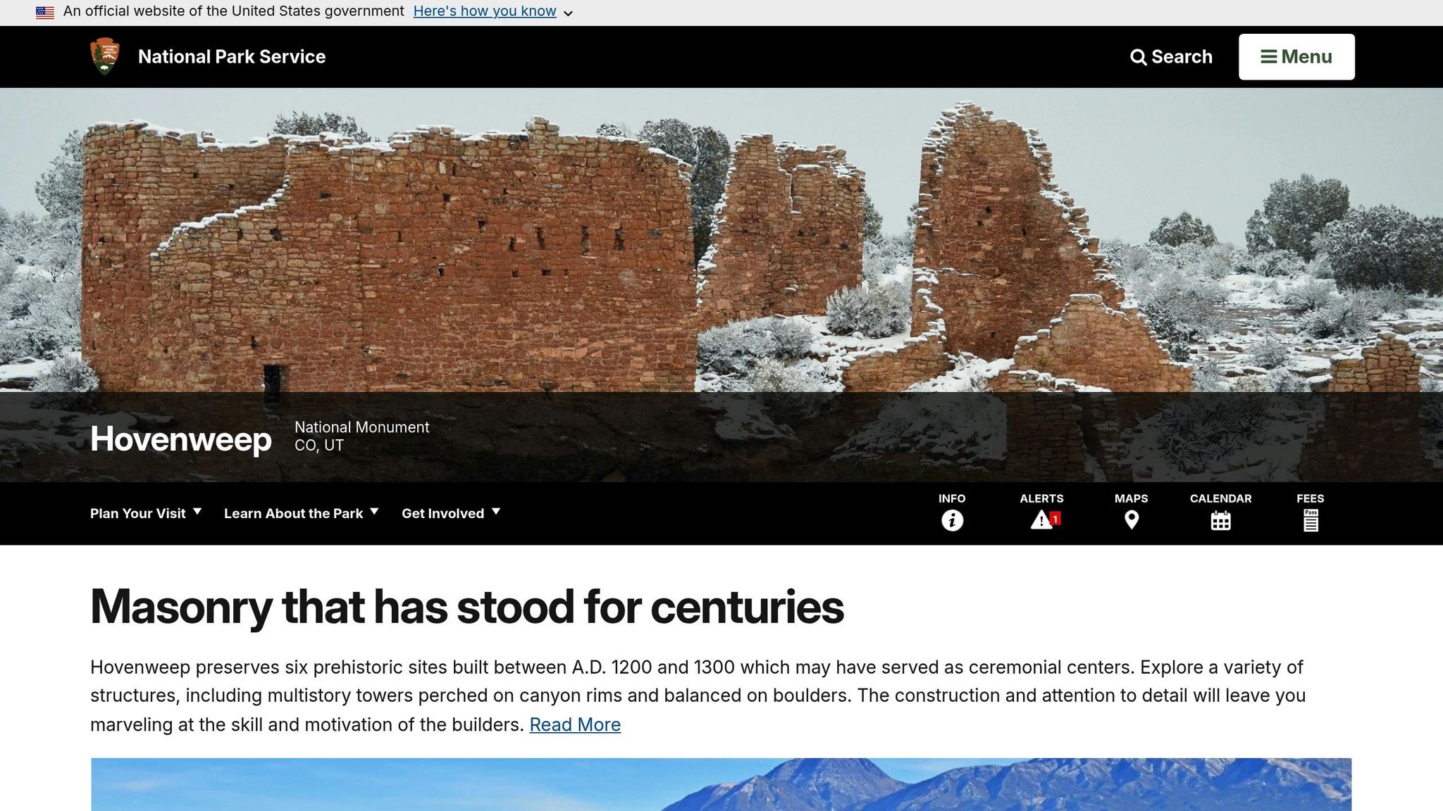
- Hovenweep National Monument (CO/UT): Features expertly crafted stone towers near water sources.
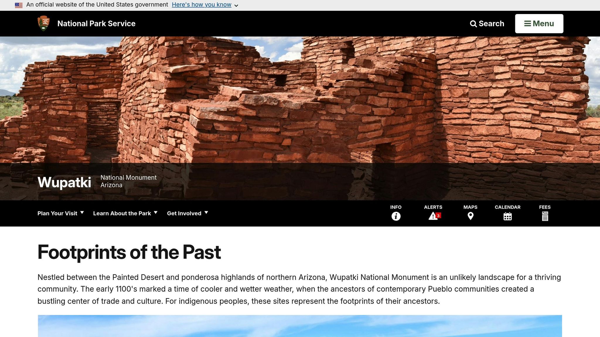
- Wupatki National Monument (AZ): A desert trading hub with multi-story pueblos and a ceremonial ballcourt.
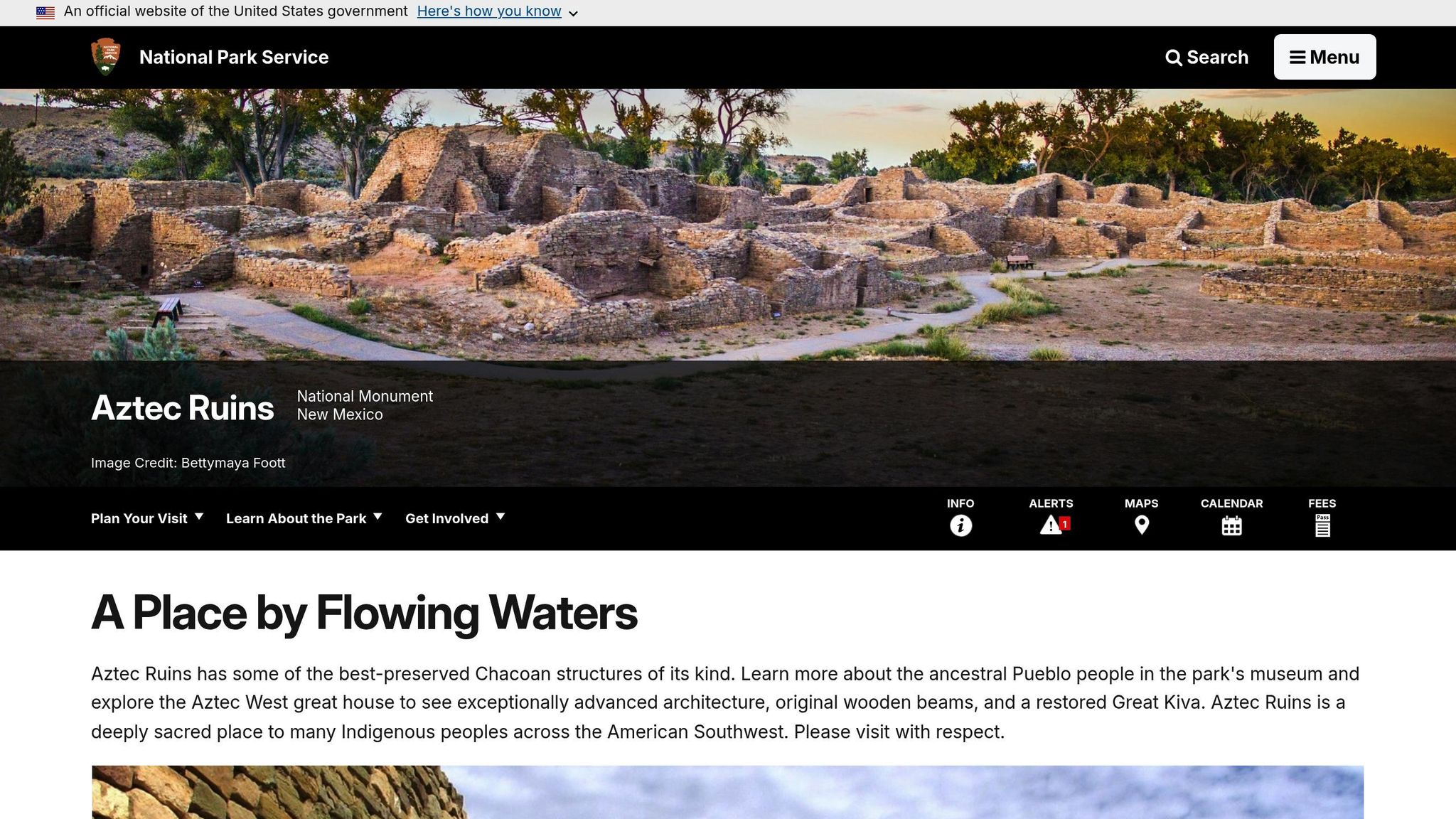
- Aztec Ruins National Monument (NM): Features a reconstructed Great Kiva and over 400 interconnected rooms.
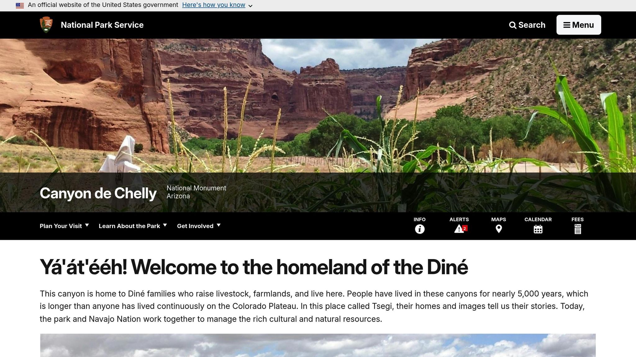
- Canyon de Chelly National Monument (AZ): A sacred Navajo site with cliff dwellings like the White House Ruin.
- White Sands National Park (NM): Preserves 22,000-year-old human footprints and prehistoric hearth sites.
- Yucca House National Monument (CO): An unexcavated pueblo site tied to Ancestral Puebloan history.
- Square Tower at Hovenweep (CO/UT): A three-story structure showcasing advanced masonry.
These parks not only protect ancient artifacts but also serve as living connections to Indigenous communities today. Most sites require ranger-led tours or have specific access rules, so plan ahead by checking park websites.
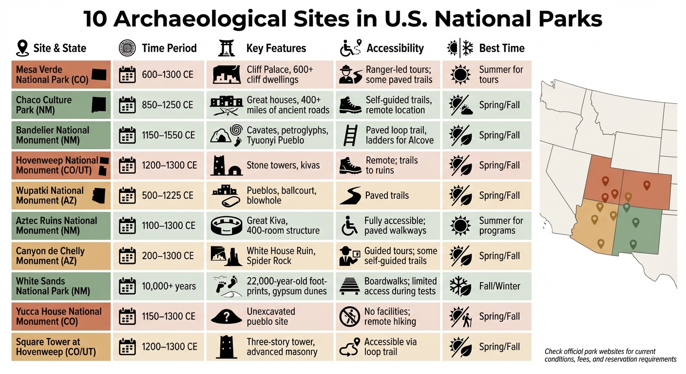
10 Archaeological Sites in U.S. National Parks: Quick Comparison Guide
6 Archaeology Sites You’ve Never Heard of in the USA
Quick Comparison
| Site Name | Time Period | Key Features | Accessibility | Best Time to Visit |
|---|---|---|---|---|
| Mesa Verde National Park | 600–1300 CE | Cliff Palace, 600+ cliff dwellings | Ranger-led tours; some paved trails | Summer for tours |
| Chaco Culture Park | 850–1250 CE | Great houses, roads, astronomy alignments | Self-guided trails, remote location | Spring/Fall |
| Bandelier National Monument | 1150–1550 CE | Cavates, petroglyphs, Tyuonyi Pueblo | Paved loop trail, ladders for Alcove | Spring/Fall |
| Hovenweep National Monument | 1200–1300 CE | Stone towers, kivas | Remote; trails to ruins | Spring/Fall |
| Wupatki National Monument | 500–1225 CE | Pueblos, ballcourt, blowhole | Paved trails | Spring/Fall |
| Aztec Ruins National Monument | 1100–1300 CE | Great Kiva, 400-room structure | Fully accessible; paved walkways | Summer for programs |
| Canyon de Chelly Monument | 200–1300 CE | White House Ruin, Spider Rock | Guided tours; some self-guided trails | Spring/Fall |
| White Sands National Park | 10,000+ years | Fossilized footprints, gypsum dunes | Boardwalks; limited access during tests | Fall/Winter |
| Yucca House National Monument | 1150–1300 CE | Unexcavated pueblo site | No facilities; remote hiking | Spring/Fall |
| Square Tower at Hovenweep | 1200–1300 CE | Three-story tower, advanced masonry | Accessible via loop trail | Spring/Fall |
Plan your visit to experience these incredible sites and learn more about the history they preserve.
1. Mesa Verde National Park Cliff Dwellings
Historical Significance
Mesa Verde holds a special place in history as the first U.S. national park dedicated to preserving cultural heritage. In 1978, it earned a spot as a UNESCO World Heritage Site, becoming one of the first seven in the United States to receive this honor for its cultural value.
"The exceptional archeological sites of the Mesa Verde landscape provide eloquent testimony to the ancient cultural traditions of Native American tribes." – National Park Service
The park serves as a bridge connecting the Ancestral Pueblo people to modern tribes such as the Hopi, Zuni, Acoma, and Rio Grande Pueblo, showcasing a legacy that resonates through generations.
Era or Time Period Represented
The story of Mesa Verde spans centuries. The Ancestral Pueblo people lived here from 550 to 1300 CE, beginning with mesa-top villages before moving into the iconic cliff alcoves by the late 1190s. This cliff-dwelling era, lasting around 75 to 100 years, ended with a large migration south around 1285 CE. This shift was likely driven by a severe drought that stretched from 1276 to 1299 CE.
Key Features and Structures
Mesa Verde is a treasure trove of archaeological wonders, preserving nearly 5,000 sites, including approximately 600 cliff dwellings. Among these, Cliff Palace stands out as the largest cliff dwelling in North America. With 217 rooms, 23 kivas, and the capacity to house over 200 people, it was constructed from sandstone and adobe and is easily recognized by its T-shaped doorways and subterranean kivas.
Beyond the cliff dwellings, the park also features mesa-top sites like the Far View Sites Complex and the Sun Temple, which highlight 600 years of earlier history. The Sun Temple’s walls rise between 11 and 14 feet, while the Far View area contains nearly 50 villages packed into just half a square mile.
Accessibility for Visitors
Exploring Mesa Verde’s ancient sites requires a bit of preparation and physical effort. Most cliff dwellings can only be accessed through ranger-led tours, and tickets must be reserved in advance at recreation.gov or by calling 1-877-444-6777. Reservations open 14 days ahead at 8:00 a.m. MDT, and tickets sell out quickly. Keep in mind, the park’s elevation – ranging from 7,000 to 7,500 feet – means tours often involve climbing ladders (up to 32 feet), crawling through tight tunnels, and navigating steep stone steps.
For those seeking a less strenuous visit, Step House offers a self-guided tour, while mesa-top sites like the Badger House Community feature paved and gravel trails that don’t require advance reservations. Tours typically run from early May through mid-October, though winter access is limited.
2. Chaco Culture National Historical Park
Historical Significance
Chaco Culture National Historical Park holds a special place among U.S. national park sites dedicated to ancient heritage. Recognized as a UNESCO World Heritage Site in 1987, it offers a striking glimpse into the lives of the Ancestral Puebloans. Chaco Canyon was the heart of their culture, serving as a hub for administration, economy, and ceremonies, influencing social and religious practices across the Four Corners region for centuries. The National Park Service describes its impact:
"Chaco dominated and altered the traditional social, economic, and religious practices over a large area in a marginal environment." – National Park Service
This site was also a major trade center, linking the region to distant Mesoamerica through the exchange of goods like turquoise, macaw feathers, and copper bells. A sophisticated network of roads – spanning over 400 miles and connecting more than 150 outlying communities – underscores Chaco’s far-reaching influence. These elements paint a vivid picture of the era when Chaco thrived.
Era or Time Period Represented
The Chacoan culture reached its peak between 850 A.D. and 1250 A.D., with the most intensive construction occurring from 1033 to 1092. By 1300 A.D., the site was largely abandoned, likely due to climate change and extended drought. Despite this, its monumental structures remained unmatched in size across North America until the 19th century.
Key Features and Structures
Spanning thousands of archaeological sites, the park showcases the ingenuity of Chacoan architecture. Among the highlights is Pueblo Bonito, the largest "great house" in the region, covering 3 acres with over 600 rooms and 40 kivas, towering up to four or five stories. Another marvel, Chetro Ketl, required immense effort to construct, involving thousands of trees and millions of stone blocks.
Visitors can also explore Casa Rinconada, a Great Kiva celebrated for its ceremonial significance and astronomical alignments. The park features over 100 smaller kivas and 15 great kivas, emphasizing their role in Chacoan ceremonial life. Petroglyphs and structural alignments further reveal the Ancestral Puebloans’ deep connection to the cosmos. These features make the park a treasure trove for those curious about ancient architectural and cultural achievements.
Accessibility for Visitors
Nestled in remote northwestern New Mexico, Chaco Culture National Historical Park lies roughly between Albuquerque and Farmington. In 2022, it welcomed 41,594 visitors. A 9-mile paved loop road provides access to six key sites, but reaching the park often requires navigating dirt roads that can become impassable after rain. Visitors are advised to check road conditions and ensure their fuel tanks are full, as services in the area are limited.
The visitor center in Nageezi offers a museum, theater, and bookstore to help visitors delve into the area’s history. From April to October, the Chaco Night Sky Program provides telescope viewing opportunities in this Gold-tier Dark Sky Park. Be prepared for extreme temperatures, which range from -38°F in winter to 102°F in summer. Out of respect for the Hopi, Pueblo, and Navajo peoples, who consider these lands sacred, visitors are encouraged to stay on marked trails and avoid touching the delicate masonry.
3. Bandelier National Monument
Historical Significance
Bandelier National Monument stands as a testament to the ingenuity and resilience of indigenous cultures. Spanning 33,000 acres, it safeguards over 3,000 archaeological sites. This area holds deep ancestral ties to 23 tribal nations, with San Ildefonso and Cochiti Pueblos continuing to honor its legacy through oral traditions. When anthropologist Adolph Bandelier first visited Frijoles Canyon in 1880, he famously described it as:
"The grandest thing I ever saw." – Adolph Bandelier
The monument’s signature cavates – dwellings carved into soft volcanic tuff – highlight the resourcefulness of its early inhabitants as they adapted to the rugged terrain. Adding to its layered history, the site served an unexpected role during World War II, when its lodge became temporary housing for scientists involved in atomic research.
Era or Time Period Represented
Bandelier’s primary period of Ancestral Pueblo occupation dates from 1150 to 1550 CE. This makes it a later cultural hub compared to landmarks like Chaco Canyon and Mesa Verde, which flourished between 500 and 1300 CE. Tree-ring analysis from Tyuonyi Pueblo reveals construction took place between 1383 and 1466 CE. By 1600, the area’s inhabitants had migrated to pueblos along the Rio Grande, where their descendants still live today.
Key Features and Structures
The 1.4-mile Pueblo Loop Trail offers a compact yet immersive experience, allowing visitors to explore major sites in under an hour. One highlight is Tyuonyi Pueblo, a circular village on the canyon floor that once stood up to three stories tall and contained 245 ground-level rooms. Nearby, the Long House features multi-story dwellings built into the canyon wall, with viga holes still visible, marking where wooden beams once supported upper levels.
For those up for a challenge, the Alcove House is a must-see. Accessible via four wooden ladders, it sits 140 feet above the canyon floor and once housed around 25 people. The site includes a reconstructed kiva, though its interior may occasionally close for maintenance. Scattered throughout the area, you’ll find cavates with blackened ceilings – not from cooking fires, but from intentional soot staining used to seal the porous volcanic rock and prevent debris from falling.
Unlike the grand, sprawling ruins of Mesa Verde or Chaco Canyon, Bandelier offers a more intimate exploration of its canyon and mesa landscapes, creating a deeply personal connection to the past.
Accessibility for Visitors
Bandelier is located in northern New Mexico and draws about 200,000 to 210,000 visitors annually. Entry fees are $25.00 per private vehicle (valid for seven days), $20.00 for motorcycles, and $15.00 per person for walk-ins or bicyclists. An annual pass is available for $45.00. From mid-May to mid-October, a seasonal shuttle service helps manage parking overflow.
Connectivity in the canyon is limited, with only Verizon 4G available and no public Wi-Fi. For winter visitors, the south-facing cavates are a cozy option, staying up to 13°F warmer than the canyon floor thanks to the sunlight. These thoughtful visitor logistics make Bandelier a welcoming destination for history enthusiasts and adventurers alike.
4. Hovenweep National Monument
Historical Significance
Hovenweep National Monument continues the story of ancient ingenuity seen in places like Mesa Verde and Chaco Canyon. It protects six Ancestral Puebloan village groups along the Colorado–Utah border, showcasing incredible prehistoric masonry skills. The name "Hovenweep", meaning "Deserted Valley", comes from the Paiute/Ute language and was adopted by photographer William Henry Jackson in 1874.
What makes Hovenweep stand out is the precision and craftsmanship of its stone structures. Sierra Coon, Chief of Interpretation at the monument, highlights this:
"The towers and rooms of Hovenweep are unique in the style and quality of their masonry. Stones are precisely cut, with smaller rocks and mortar sealing gaps against the elements and pests."
Even the National Park Service acknowledges the superior construction quality, stating, "Even the cliff dwellings of Mesa Verde rarely exhibit such careful construction and attention to detail". By the late 1200s, this desert region was home to over 2,500 people, who strategically built their towers near essential seep springs.
Era or Time Period Represented
While human activity in this area dates back more than 10,000 years, the stone structures that remain today were built between A.D. 1200 and 1300. Permanent settlement began around A.D. 900, as people shifted from a nomadic lifestyle to farming. However, by the late 1200s, the communities were abandoned due to prolonged drought, resource scarcity, and internal conflicts. Many inhabitants migrated south to the Rio Grande Valley and the Hopi mesas. Today’s Pueblo, Zuni, and Hopi peoples trace their lineage back to these ancient builders.
Key Features and Structures
The Square Tower Unit is the centerpiece of Hovenweep and the easiest to access. Its iconic three-story Square Tower stands atop a massive boulder at the head of Little Ruin Canyon. Visitors can explore this area via a 2-mile loop trail, which takes about 1 to 2 hours to complete. Along the way, you’ll encounter Hovenweep Castle, kivas, and ancient petroglyphs.
The towers at Hovenweep come in various shapes – square, oval, D-shaped, and circular – and are often located near critical water sources. The Holly Group features the "Tilted Tower", a multi-story pueblo built on a sandstone boulder that began to tilt after A.D. 1300. The Cajon Group includes a circular tower built to fit three irregular boulders, along with pictographs painted in the Mesa Verde pottery style. The Cutthroat Castle Group breaks from the typical canyon rim design, with structures deeper in the canyon and a high number of kivas. Each site offers a unique glimpse into the lives of its builders, making careful planning essential for visitors.
Accessibility for Visitors
For those planning a visit, the Square Tower Unit is the most accessible, with a paved road leading to the visitor center. The other units – Cajon, Holly, Cutthroat Castle, Goodman Point, and Horseshoe/Hackberry – require high-clearance vehicles and travel on unpaved roads, which can be challenging depending on weather conditions. Park officials strongly recommend using physical maps or official NPS directions, as GPS can be unreliable in this remote area.
Hovenweep is also an International Dark Sky Park, a designation it received on July 1, 2014. Visitors can enjoy breathtaking views of up to 15,000 stars, making it a must-visit for night sky enthusiasts.
5. Wupatki National Monument
Historical Significance
Wupatki National Monument stands as a testament to human ingenuity and the ability to thrive in harsh desert conditions. Following the 1085 CE eruption of Sunset Crater, residents cleverly used volcanic ash as mulch to retain moisture for farming in an area that receives just 8.2 inches of rainfall annually [44,45].
This site was more than a home – it was a bustling trading hub and a meeting point for three Ancestral Puebloan cultures. Archaeologists have unearthed fascinating artifacts like copper bells, macaw parrots, turquoise, and coastal shells, highlighting the extensive trade networks of the time. Today, the Hopi and Zuni communities regard Wupatki as a sacred place, believing their ancestors remain here as spiritual guardians [44,48].
Era or Time Period Represented
While human activity in the area dates back 13,000 years, the pueblos that dominate the landscape were constructed between 1100 and 1250 CE. By 1182, Wupatki Pueblo was home to 85–100 people, making it the largest settlement within a 50-mile radius [43,46,47,49]. These communities thrived for around 150 years before moving on, leaving behind an impressive legacy of over 2,600 ancestral sites spread across 35,422 acres [44,46].
Key Features and Structures
Wupatki Pueblo is the crown jewel of the site, boasting 104 rooms with three-story walls up to 6 feet thick – the largest free-standing pueblo in northern Arizona [44,48]. It also features a ceremonial ballcourt and a natural blowhole that reacts to atmospheric pressure changes, adding a unique touch to the landscape [43,44,48].
Visitors can explore several other pueblos along a scenic loop road. Highlights include:
- Wukoki Pueblo: Known for its well-preserved three-story tower perched on a sandstone outcrop, accessible via a short 0.2-mile loop [44,47].
- The Citadel: Positioned on a cinder hill, offering views of a nearby geologic sinkhole.
- Lomaki Pueblo: Aptly named "beautiful house", it reveals ancient water conservation techniques, including a prehistoric check dam [43,44,47].
Accessibility for Visitors
The visitor center, located 13 miles from the north entrance on Highway 89, offers museum exhibits and trail guides for $2.00 [47,48]. Admission costs $25.00 per vehicle and is valid for seven days, typically covering access to Sunset Crater Volcano and Walnut Canyon as well [44,48].
For those with mobility considerations, a paved path with a gentle grade (less than 5%) leads from the parking lot to the Wupatki Pueblo overlook [48,49]. Exploring the accessible pueblos takes about two hours. Visitors are encouraged to stay on designated trails to protect the fragile masonry and honor the site’s importance to the 13 tribes traditionally associated with it [44,48].
6. Aztec Ruins National Monument
Historical Significance
Despite its name, Aztec Ruins National Monument has no connection to the Aztec Empire. Early European settlers mistakenly attributed this ancestral Pueblo site to the Aztecs. In reality, it served as a significant trade, ceremonial, and administrative hub tied to Chaco Canyon during its decline around 1100 A.D.. The site holds deep cultural significance for 26 modern tribes, including the Hopi, Navajo, and Pueblo nations, who continue to honor its ancestral legacy. Recognized as a UNESCO World Heritage Site in 1987, the monument covers 318 acres in Aztec, New Mexico, and contributed approximately $3.1 million to local gateway communities in 2023.
Era or Time Period Represented
Construction of the site began in the late 1000s, thriving until the late 1200s before being largely abandoned by 1300 A.D. due to drought and societal changes. The West Ruin, a standout feature, includes over 400 interconnected rooms, with some walls towering up to 30 feet. Excavations have uncovered fascinating artifacts like cotton textiles, fiber sandals, turquoise jewelry, and macaw remains, offering a glimpse into the sophisticated lifestyle of its builders.
Key Features and Structures
The Aztec West Great House is a marvel of engineering, built with 900-year-old beams of pine, spruce, and aspen. Its T-shaped doorways and the region’s only reconstructed Great Kiva showcase the architectural ingenuity of the ancestral Puebloans. Another highlight is the Hubbard Site, a tri-walled structure with 22 rooms encircling a central kiva. This site’s alignment with solstices reflects the advanced astronomical knowledge of its creators. Together, these structures offer visitors a chance to connect with the rich cultural and scientific achievements of the past.
Accessibility for Visitors
Aztec Ruins National Monument is open year-round with free admission. Visitors can start at the center, which features exhibits and a 15-minute orientation video. A paved, half-mile self-guided loop trail – accessible to all – takes about 1–2 hours to complete. During summer, 30-minute ranger programs highlight the solstice alignments. Pets are welcome in designated areas like the parking lot, picnic area, and Old Spanish Trail. To protect the 900-year-old masonry and respect the sacred nature of the site, visitors are asked to stay on marked paths.
sbb-itb-00512f3
7. Canyon de Chelly National Monument
Historical Significance
Canyon de Chelly holds a deep connection to human history, with evidence of habitation stretching back nearly 5,000 years. Uniquely, it is the only site in the National Park System entirely owned by a tribal entity. Managed in collaboration with the Navajo Nation, the monument is still home to around 40 Navajo families who continue traditional farming and livestock raising practices.
However, the canyon’s history is not without sorrow. In 1864, the U.S. military forced 8,000 Navajo people to endure the grueling 300-mile Long Walk to Fort Sumner. Earlier, in 1805, Lt. Antonio Narbona’s expedition resulted in the massacre of 115 Navajo at what is now known as Massacre Cave. These events are etched into the landscape, adding layers of meaning to its already rich past.
Era or Time Period Represented
Canyon de Chelly showcases cultural remnants from five distinct groups over thousands of years.
- The Archaic people (2500–200 B.C.): They lived in seasonal camps, relying on hunting and gathering.
- The Basketmakers (200 B.C.–A.D. 750): This group shifted to farming and built pithouses with large granaries.
- The Pueblo people (750–1300 A.D.): Known for constructing multi-story stone villages and cliff dwellings, including the White House Ruin, which dates back to 1060–1275 A.D.
- The Hopi (1300–1600s): Following the Great Drought, they used the canyon for seasonal farming and religious pilgrimages.
- The Navajo (1700–present): Migrating from the north, they introduced domesticated animals and established a lasting presence in the canyon.
This timeline reflects the canyon’s role as a living record of human adaptation and culture through the ages.
Key Features and Structures
The monument spans 83,840 acres, with towering sandstone walls that rise 1,000 feet and house numerous archaeological treasures. Among its highlights:
- Spider Rock: A striking 750-foot sandstone spire, deeply rooted in Navajo tradition as the dwelling of Spider Grandmother.
- Mummy Cave: Perched 300 feet above the canyon floor, this ancient village features nearly 70 rooms adorned with white and pale green plaster.
- White House Ruin: Named for the white plaster on its upper walls, this ancestral Puebloan site is one of the most accessible and iconic structures in the canyon.
These features provide a glimpse into the lives of those who called the canyon home.
Accessibility for Visitors
Visitors can enjoy the canyon rims year-round at no cost. The North Rim Drive offers stunning morning views of Mummy Cave and Massacre Cave, while the South Rim Drive is perfect for afternoon lighting on Spider Rock and White House Ruin.
Access to the canyon floor requires a Navajo guide, except for the 2.5-mile White House Trail, which is set to reopen seasonally in April 2025. For a more immersive experience, Navajo-owned companies provide guided tours by horseback, hiking, or 4WD, available for separate fees.
Be mindful of the desert climate – summer temperatures can soar to 100°F at the 5,500-foot elevation. Visitors should pack plenty of water and sun protection to stay safe during their adventure.
8. White Sands National Park
Historical Significance
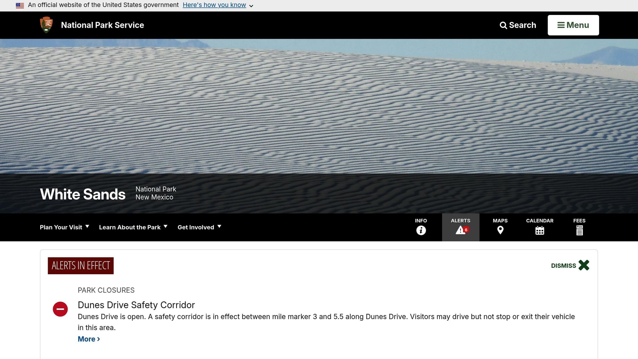
White Sands National Park offers a fascinating glimpse into early human life in North America. Fossilized human footprints found here date back about 22,000 years BP, pushing back the timeline of human presence on the continent by nearly 9,000 years compared to earlier estimates.
The park is also known for its prehistoric hearth mounds – ancient campfires formed when heated gypsum sand solidified, trapping charcoal, ash, and artifacts within. These features have been described by the National Park Service as:
"time capsules in the dunes" that have preserved archaeological evidence for thousands of years.
The Tularosa Basin has a continuous human history spanning over 23,000 years, beginning with nomadic Paleo-Indian hunters who followed megafauna, transitioning to Archaic foragers, and later evolving into the agricultural communities of the Jornada Mogollon people. These communities cultivated staples like corn, beans, and squash, leaving a rich cultural legacy in the region.
Era or Time Period Represented
The park’s archaeological record covers five distinct periods: Paleo-Indian (c. 22,000 years BP), Archaic (starting ~4,000 years ago), Jornada Mogollon (200–1350 CE), Apache (emerging over 700 years ago), and the Historic Era (spanning from Spanish salt mining in the 1820s to military activities in the mid-20th century). During the Paleo-Indian period, footprints were left in the basin as Lake Otero shaped the landscape. The Jornada Mogollon period marked advancements in pottery-making and agriculture, with villages established near vital water and salt resources [70,74].
Key Features and Structures
White Sands boasts the world’s largest gypsum dunefield, stretching across an impressive 275 square miles. Despite its vastness, only about 5% of the park has undergone detailed archaeological surveys, as the terrain poses significant challenges. Remote sensing has pinpointed 882 potential archaeological sites, with radiocarbon dating showing that the dunes were intermittently occupied from around 2500 BC to AD 1300. Notable sites include Lake Lucero and the Huntington Site, both strategically situated near fresh water and salt deposits.
Accessibility for Visitors
Visitors can explore these ancient landscapes by taking Dunes Drive, an 8-mile scenic route that provides access to areas where many archaeological features are visible. However, due to nearby missile testing, access may be restricted to three-hour windows, so it’s wise to check for closures before planning your visit. Ranger-led tours of Lake Lucero offer a deeper dive into the gypsum dunes’ origins and the area’s long human history.
Because the gypsum reflects about 80% of the sun’s rays, sun protection is a must, no matter the season. Carry at least one gallon of water per person, as the only water source is at the visitor center. Removing sand or artifacts is strictly prohibited under federal law, with penalties of up to $5,000 or six months in jail. If you come across any artifacts, leave them untouched and notify a ranger to help preserve the park’s historical treasures.
9. Yucca House National Monument
Historical Significance
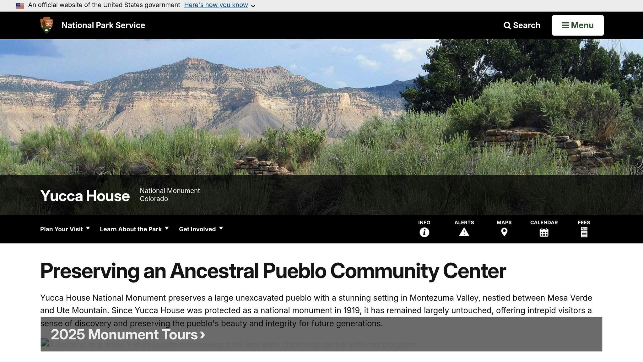
Yucca House is one of the largest archaeological sites in southwest Colorado, serving as a key center for the Ancestral Puebloans [77,79]. Its untouched state preserves its original archaeological features, offering a rare glimpse into the past. The site was officially established as a national monument on December 19, 1919, when Henry Van Kleeck donated 9.6 acres to the federal government. This act represents an early example of collaboration between private citizens and public institutions to protect archaeological heritage.
The National Park Service emphasizes its importance:
"The long-term preservation of Yucca House ensures that archeologists will be able to continue studying Ancestral Puebloan society and what caused them to migrate from this region in the late 1200s."
This historical context provides insight into the significance of the site’s timeline and occupation.
Era or Time Period Represented
Yucca House is linked to the Great Pueblo Period, spanning AD 1150–1300 [77,78]. During this time, the Ancestral Puebloans constructed a thriving community centered around Aztec Spring, a natural water source integral to the settlement. Interestingly, the use of adobe in the Upper House is an unusual feature for pre-1200s structures, hinting at possible connections with other groups and influences.
Key Features and Structures
The site is divided into two main areas. The Upper House, a striking 80×100-foot structure, rises 15–20 feet above the ground and is surrounded by rooms on all sides. Nearby, the West Complex is believed to contain up to 600 rooms and over 100 small kivas. About 600 feet to the east lies the Lower House, an L-shaped pueblo with some of the site’s few visible masonry remains, including at least eight rooms and a 50-foot ceremonial depression. Builders used fossiliferous limestone, rich with 90-million-year-old marine fossils, as a primary construction material [78,80].
Accessibility for Visitors
Reaching Yucca House can be a bit of an adventure. There are no directional signs, and the monument is located on private ranch land. To visit, take MC County Road B from Highway 491 for 1.4 miles, heading toward a white ranch house with a red roof. Be sure to close any gates behind you to keep livestock secure.
The site is fee-free but completely undeveloped – there are no restrooms, water, food, or fuel available. Visitors should wear sturdy shoes and be mindful of cacti, snakes, and the intense summer heat. For those collecting National Park Passport stamps, they are available only at the Mesa Verde National Park Visitor and Research Center.
10. Hovenweep National Monument Square Tower
Historical Significance
The Square Tower is the centerpiece of what was once a thriving Hovenweep community, which supported up to 500 people at its height between A.D. 1200 and 1300. Perched above a permanent spring in Little Ruin Canyon, this three-story structure showcases the remarkable masonry skills of the Ancestral Puebloans during the 13th century. The spring was vital to the settlement, serving as a dependable water source. While its exact purpose remains unclear, archaeologists speculate the tower may have been used for water management, protection, celestial observation, or ceremonial purposes. Like other structures at Hovenweep, the Square Tower is a testament to the resourcefulness and craftsmanship of its builders, marking a significant chapter in the area’s history.
Era or Time Period Represented
The Square Tower was constructed during the Pueblo III period (A.D. 1200–1300), the final era of Ancestral Puebloan habitation in the Four Corners region. At its peak, Hovenweep’s six communities were home to nearly 2,500 people. However, by around A.D. 1300, the inhabitants were forced to leave due to a combination of prolonged drought, resource shortages, and conflict. Many migrated south to the Rio Grande Valley and Hopi mesas. Recognizing its historical importance, Hovenweep was designated a National Monument on March 2, 1923, to protect what has been described as some of the finest prehistoric masonry in the United States.
Key Features and Structures
The Square Tower stands atop a large sandstone boulder, featuring a subtle spiral shape and a single T-shaped doorway facing southwest. Traces of an earlier entrance, which faced the spring, are still visible. The surrounding Square Tower Group includes other notable structures, such as Hovenweep Castle, distinguished by its thick masonry walls and D-shaped towers, and Hovenweep House, which overlooks the tower. Prehistoric check dams, designed to manage stormwater runoff, are also part of the area. Additionally, archaeologists have uncovered nearly 30 kivas along the canyon slopes, emphasizing the ceremonial importance of the site.
Accessibility for Visitors
The Square Tower Group is the most visitor-friendly area of Hovenweep, accessible via a paved road. It is located about an hour’s drive from Cortez, Colorado, or from Bluff and Blanding, Utah. This section serves as the park’s hub, offering a visitor center, campground, and restrooms. A 2-mile loop trail along the canyon rim provides excellent views of the Square Tower and typically takes 1 to 2 hours to complete. Keep in mind that GPS can be unreliable in the area; it’s better to rely on paper maps or search for "Hovenweep National Monument Visitor Center" for accurate directions. Visitors are not allowed to approach the tower’s base to preserve its delicate structure, but it is easily visible from the rim trail. Summer temperatures often reach the high 90s°F or even exceed 100°F, so it’s essential to bring plenty of water.
Tips for Visiting Archaeological Sites
Preserving ancient sites begins with respecting the rules designed to protect them. Never touch, move, or collect artifacts like pottery fragments or stone chips. Not only is this illegal under federal law, but it also disrupts vital research efforts. Rock art, such as pictographs and petroglyphs, is particularly delicate – oils from your skin can cause irreversible damage. Avoid touching or leaning on these surfaces, and remember, ancient walls and structures are often more fragile than they appear.
When visiting, follow these simple practices to minimize your impact. Stick to designated trails to protect both the site and its surroundings. Venturing off-trail can harm fragile soils and native plants. For instance, at Arches National Park, staying on marked paths is essential to safeguard living soil crusts. Visitors are also prohibited from building new rock cairns, as these can mislead others. Additionally, eating at archaeological sites is discouraged – crumbs can attract rodents, which may further damage these areas.
"Think about how you’d like someone else to act around your ancestors or when visiting your home or place of worship." – National Park Service
Planning ahead is key to a smooth visit. Seasonal conditions and site-specific requirements can greatly affect your experience. From May through September, many parks offer ranger-led tours and cultural programs, while spring and fall bring more comfortable hiking weather. Be cautious during summer, as desert temperatures can soar past 100°F. Always carry at least 1 gallon of water per person per day in these conditions. Some parks, such as Arches National Park, require timed entry reservations from April 1 to October 31, while others, like Mesa Verde, mandate reservations for ranger-led tours.
Entrance fees are standard, but sites often accept the America the Beautiful Pass. Trail options range from short, self-guided loops to longer backcountry routes. Check with visitor centers for current trail conditions and updates. Finally, if you witness vandalism or artifact theft, document what you see with photos and report it to a park ranger immediately – avoid confronting individuals directly.
Site Comparison Table
The table below provides a quick-reference guide to compare essential details for various archaeological sites. It complements the detailed descriptions above and can help streamline your planning.
| Site Name | Age/Era | Key Features | Accessibility | Best Visiting Season |
|---|---|---|---|---|
| Mesa Verde National Park | 600–1300 CE (Ancestral Pueblo) | Famous cliff dwellings; a UNESCO World Heritage Site showcasing over 700 years of Ancestral Pueblo history | Access to cliff dwellings requires ranger-led tours; paved overlook trails available | Summer for guided tours; winter offers quieter visits with snowshoeing opportunities |
| Chaco Culture National Historical Park | 850–1250 CE (Ancestral Pueblo) | A major pre-Columbian urban center with advanced masonry and road systems | Self-guided trails available; some paths are accessible, and backcountry hiking is an option | April–October for special programs and guided hikes |
| Bandelier National Monument | 1150–1550 CE (Ancestral Pueblo) | Features scenic cliff dwellings and petroglyphs carved into volcanic rock | Includes a paved Main Loop Trail (approx. 1.2 miles) for easy access | Spring and fall for mild hiking weather |
| Hovenweep National Monument | 1200–1300 CE (Ancestral Pueblo) | Known for six prehistoric villages and distinctive tower structures | Accessible via self-guided trails | Spring and fall are ideal; summer heat can be intense |
| Wupatki National Monument | 500–1225 CE (Ancestral Pueblo) | Multi-story pueblos built with striking red Moenkopi sandstone | Paved, wheelchair-accessible trail leads to Wupatki Pueblo | Spring and fall; summer temperatures often exceed 100°F |
| Aztec Ruins National Monument | 1100–1300 CE (Ancestral Pueblo) | Features a great house and a reconstructed Great Kiva | Paved walkways with self-guided tours; fully accessible Aztec West area | May–September for ranger-led tours and cultural events |
| Canyon de Chelly National Monument | 200–1300 CE (Ancestral Pueblo) | Dramatic canyon walls with sacred cliff dwellings; important to the Navajo Nation | Accessible rim drives; canyon floor access typically requires a Navajo guide, except for the White House Trail | Spring and fall for moderate weather |
| White Sands National Park | 10,000+ years (various cultures) | A breathtaking gypsum dune landscape with traces of early human activity | Accessible boardwalks and firm trails for self-guided exploration | Fall through spring for comfortable temperatures; summer heat can be extreme |
| Yucca House National Monument | 1150–1300 CE (Ancestral Pueblo) | An unexcavated pueblo mound with limited development | Requires cross-country hiking; no marked trails or facilities | Spring and fall are best; check conditions beforehand |
This table highlights the variety of experiences offered at archaeological sites across the U.S., emphasizing their historical and cultural significance. Be mindful of seasonal weather, as desert locations can experience extreme heat in summer. For the most up-to-date information on accessibility and reservations, visit the official park websites before planning your trip.
Conclusion
The archaeological sites within U.S. national parks are far more than ancient artifacts – they serve as vibrant links to the past, showcasing how people thrived in challenging environments, built complex societies, and left behind legacies that endure to this day. These parks safeguard an incredible array of archaeological treasures that stretch across thousands of years.
These remnants of the past are deeply meaningful to many communities today. For instance, Mesa Verde holds strong ties to 27 Pueblos and Tribes, while the Grand Canyon remains culturally significant to 11 traditionally associated tribes. As the National Park Service aptly puts it:
"The stories revealed by archeologists bring a unique perspective to the present and to our choices about the future".
Exploring these sites offers a glimpse into human creativity, resilience, and the importance of preserving our collective heritage. Whether you’re marveling at the intricate stonework of Chaco Culture or wandering through the sandstone pueblos of Wupatki, each visit deepens our insight into history and its lessons for the future.
If you’re planning a trip, consider seasonal weather, accessibility, and the need for ranger-led tours in some areas. For the latest updates on conditions, fees, and tips, check out The National Park Guide. From iconic destinations like Mesa Verde to lesser-known gems like Yucca House, these parks provide countless opportunities for a memorable archaeological journey.
FAQs
When is the best time to visit these archaeological sites for pleasant weather?
The best time to visit these archaeological sites is usually between late spring and early fall, roughly spanning April to October. During this period, the weather tends to be more pleasant, offering comfortable temperatures that make exploring much easier. You’ll avoid the obstacles of winter snow and steer clear of the peak summer heat.
Before finalizing your plans, it’s a good idea to check the local weather for each site, as conditions can differ depending on the region.
What accessibility options are available for visiting archaeological sites in U.S. national parks?
Exploring archaeological sites within U.S. national parks can be an unforgettable adventure, and many parks go the extra mile to ensure these experiences are accessible to everyone. To help preserve these delicate sites, it’s crucial to stick to designated paths, avoid touching any artifacts, and steer clear of activities like digging or using metal detectors. A little preparation can also make a big difference – choosing routes that align with your mobility needs is a great place to start.
The National Park Service offers a range of accessibility features to make visits more inclusive. These include wheelchair-friendly trails, boardwalks, and restrooms. Some parks even provide all-terrain motorized wheelchairs for navigating tougher terrain. At visitor centers, you’ll often find resources like audio-described exhibits, tactile displays, braille materials, and assistive-listening devices. To ensure a smooth trip, check ahead for accessible parking, adaptive equipment options, and any necessary reservations. With thoughtful planning, these incredible sites can be enjoyed by all.
How do these archaeological sites reflect and preserve Indigenous heritage today?
The archaeological sites within U.S. national parks hold profound significance for Indigenous cultures, acting as bridges between the past and present. Take the Russell Cave National Monument, for instance – it offers a glimpse into prehistoric practices that continue to live on through oral traditions. Similarly, the Alagnak Wild River supports time-honored subsistence activities like fishing and hunting, which remain integral to nearby Indigenous communities. Sacred earthwork mounds, such as those at Hopewell Culture National Historical Park and Ocmulgee Mounds, are still revered as ceremonial spaces by descendant tribes.
Today, many of these sites serve as vibrant centers for cultural events, educational programs, and ceremonies held in partnership with tribal nations. Visitors can immerse themselves in Indigenous heritage through engaging interpretive signs, guided tours, and museum exhibits that often include the voices of tribal members. These efforts not only celebrate the enduring legacy of these cultures but also ensure their stories and traditions are passed down to future generations.